June 15-19, 2015
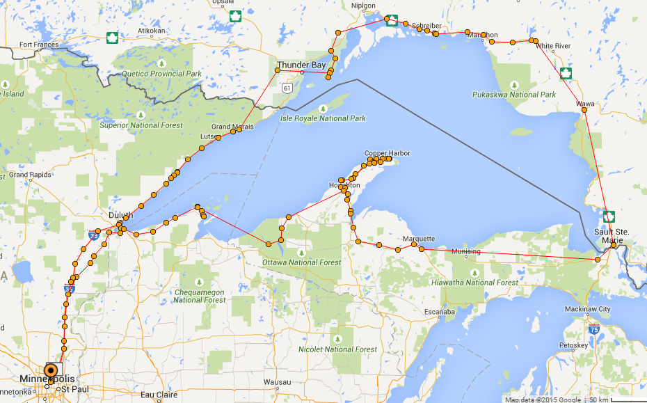
My friend Jason and I took off on a motorcycle trip around Lake Superior for 5 days. In total, my motorcycle odometer registered 1,831.8 miles, starting at my house and returning.
We were inspired by our stops by following the Ride Lake Superior website. They have a great route planned and we saw almost everything we were hoping for.
 Day 1 - 425 miles
New Brighton, Minnesota to Sleeping Giant Provincial Park, Ontario, Canada
Jason and I got going around 8am. I was packed and ready the day before, so I only had to get on the bike and go. Jason had a few last minute things at his place to finish up, but he was ready.
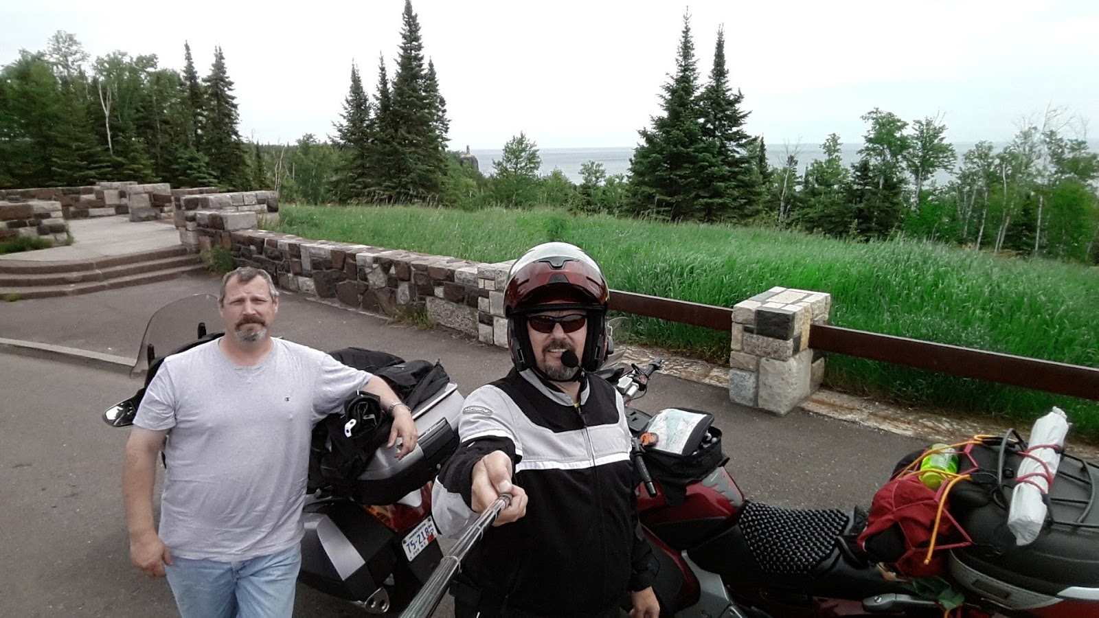 |
| Teeny Split Rock Lighthouse behind us |
First we just headed straight up 35W to Duluth. It was a good time for a stop so we stopped at the Aerostich factory in Duluth, MN. We got a tour of their facility and I ended up purchasing a throttle lock for the trip. This really helped with the long distances. Once north of Duluth, we made a quick stop for a photo with Split Rock Lighthouse in the back ground. This is a must for me. For lunch we stopped at the Northern Lights Roadhouse. They have a great Hunter's Pie for good rib sticking food.
 |
| Palisade Head, Minnesota |
 |
| Kakabeka Falls, Ontario |
We skipped on our way up to the US/Canada border. Nothing significant to report there. From a person in the Ontario visitor's center gave we got a short cut to Kakabeka Falls.
It was getting late after all this driving, so we grabbed a quick bite in Thunder Bay, a six pack of beer, and headed to Sleeping Giant Provincial Park where we stayed the night. We got the tent up by night fall, had a few beers and hit the sack.
Day 2 - 476 miles
Sleeping Giant Provincial Park to Sault Ste. Marie
Funny Story During the night, I was sleeping soundly when I awoke to having Jason on his knees looking at the edge of the tent. Took me a second to figure out it was him and I asked what was up. He said his face was up against the tent side and he awoke getting his face pushed from the outside with loud deep sniffs, and there was a great stench. Probably a bear? We made some noise and turned on flashlights and it eventually went away.
In the morning we had a few campsite visitors while we made oatmeal and coffee.


After packing up gear, we headed to the end of the road down to Silver Islet, Ontario. Small town area with a few homes and a general store. I saw a website said it was a ghost town, but looked alive to me.

We headed to Ouimet Canyon. This is a very cool geographical anomaly in the area with a few theories on how it was created.


Along the north shore of Lake Superior are many beautiful vistas. There were lots of places to stop for a photo op. Fewer places for gas, so we topped off our tanks often. This also gave us a short break on our way for a cup of coffee or snack.

The most interesting thing is how cold it gets from the north side all the way to Sault Ste Marie. Small canyons off from the lake were easily 10-15 degrees colder than up above.
We did find Aguasabon Falls and some Agawa Rock Pictographs to see on our way.
Flurries were predicted for the next day along the east shore of Lake Superior (our destination), so we decided to drive on through to Sault Ste Marie and get a hotel. The weather was cold, but we both had enough to wear. This was our longest riding day at 476 miles.
In the morning we had a few campsite visitors while we made oatmeal and coffee.


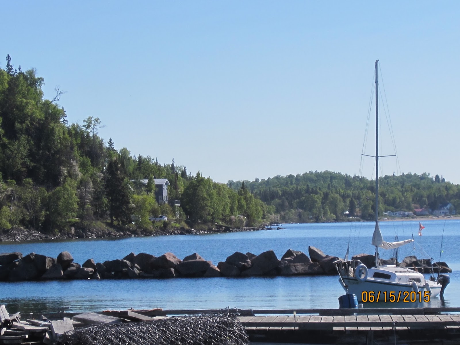
After packing up gear, we headed to the end of the road down to Silver Islet, Ontario. Small town area with a few homes and a general store. I saw a website said it was a ghost town, but looked alive to me.

We headed to Ouimet Canyon. This is a very cool geographical anomaly in the area with a few theories on how it was created.


Along the north shore of Lake Superior are many beautiful vistas. There were lots of places to stop for a photo op. Fewer places for gas, so we topped off our tanks often. This also gave us a short break on our way for a cup of coffee or snack.

The most interesting thing is how cold it gets from the north side all the way to Sault Ste Marie. Small canyons off from the lake were easily 10-15 degrees colder than up above.

 |
| Aguasabon Falls, Terrace Bay, ON, Canada |
 |
| Agawa Rock Pictographs |
 |
| Young's General Store |
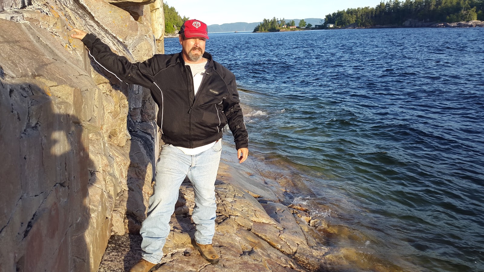 |
| Pictographs are right on the water - watch your step |
Flurries were predicted for the next day along the east shore of Lake Superior (our destination), so we decided to drive on through to Sault Ste Marie and get a hotel. The weather was cold, but we both had enough to wear. This was our longest riding day at 476 miles.
Day 3 - 399 miles
 |
| Point Iroquois Lighthouse |
Breakfast was in the hotel so it was easy to get going. Got a little lost in town trying to get to the U.S. border, but the crossing went off without a hitch. We headed to the Point Iroquois Lighthouse.
 |
| Tahquamenon Falls |
 |
| Jay Flying |
The path to follow on the Ride Lake Superior map was a good ride. It's not the Google maps most efficient route, but probably better.
Day 4 - 296 miles
Copper Harbor, Michigan to Little Sand Bay Campground, Bayfield, WisconsinWednesday night I was starting to get sore and grumpy. I was looking for a restaurant/bar close by our sleeping area. Since it was cold again, and the campground appeared to have nothing next door to it, I pushed for a motel again. We stayed at The Pines for the night. Clean and a bar right next door. A good restaurant was across the street too.
Copper Harbor is a small fishing type village on the coast. It appears that winter is big for this town, providing lots of sledding information. Summer is 4x4 oriented.


In in the morning we head east on the Keweenaw Peninsula to Fort Wilkins Historic State Park. It cost $9 per bike to get in, but we could explore the area. Hint: The pass is good for other parks during the day, btw.
 |
| Family Housing outside Fort Wilkins |
This Fort advertises as being the most complete Fort representation from it's day.
 |
| Copper Harbor from Brockway Mountain Drive |
The night before, a local told us about taking Brockway Mountain Drive when we headed out of town. We rode west along the coast, popping up on the highway going up over the hills. Very cool ride. It was a great site where we could get some shots of Copper Harbor from above.
 |
| Wide picture of Copper Harbor |
 |
| Jason the Photo Guy |

 |
| An area close by called Eagle Harbor has a great perspective on where other parts of Lake Superior. |
 Jason was pretty interested in the Delaware Copper Mine. I was impressed with how much is left still. Walked down steps to be about 100 feet below ground, with 1400 ft of tunnel to explore. Hint: Bring a flashlight. I didn't get pictures here, but Jason snapped a few up top.
I was impressed with the Michigan Upper Peninsula in how much is not developed, with vast forested areas and coastline. We set a route that closely matched the suggested Ride Lake Superior route. Once over the border in Wisconsin though, there appeared to be almost instant population.
 We got to our destination at Little Sand Bay Campground on the northern peninsula across from Sand Island. $25 a night for power, grassy areas, nice. This is not officially on the RLSuperior route, but Jason knew about it. We forgot to stop and grab food on our way past Bayfield, so we setup camp and headed back to town for food and a six pack.
We took a few photos while enjoying our beers on the dock.

Day 5 - 235 Miles
Little Sand Bay Campground to New Brighton, Minnesota |
| Oatmeal and Coffee Breakfast |
Shorter ride today. We made such good time/mileage of the last few days, this was going to be easier. Since Jason gets up at like 5:30AM, we got a good start on the day. There was a RLSuperior stop on the map at Ehlers General Store, but they weren't open yet. We decided just to ride on to Superior, Wisconsin. We stopped for coffee in Superior, then decided to take a nice final ride down Hwy 23. We were home by 1pm, which was nice.
 |
| Little Sand Bay Campground |


Travel Days; June 15-19, 2015
Total Mileage: 1,831